
IOOS HF Radar
IOOS operates the nation’s only high-frequency (HF) radar network, providing real-time information on the speed and direction of surface currents. This network supports search and rescue operations, response to oil spills, marine shipping navigation, monitoring and tracking harmful algal blooms and coastal water quality monitoring. The data are also routinely ingested into oceanographic models. Research is exploring the use of HF radar for application to tsunami detection and monitoring significant wave heights. The network currently consists of approximately 140 radars in nearly every coastal state plus Puerto Rico.
Registration at http://rowg.org/bin/view/System/UserRegistration is strongly encouraged to enable access to the latest documents on data management and analysis. NOTE: ROWG.org is a wiki so registration is required and is moderated. Therefore, one’s access will not be immediate.
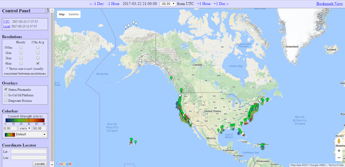
This Scripps page is the development site for the national HF radar network and gives access to radar site metadata and diagnostics. The radar sites are marked with green, red, yellow or white balloon markers.
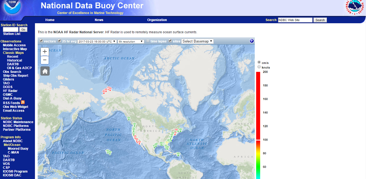
This National Data Buoy Center page is accessed here.